Rose Center Fellows Hail From Thriving Cities and Balance Competing Demands
Each year, the ULI Rose Center for Public Leadership selects leaders from four large American cities to participate in the Daniel Rose Fellowship, a yearlong peer exchange program. Each fellowship team is assigned an advisory panel, composed of senior ULI members and other fellowship participants, to provide objective feedback on a specific and particularly challenging land use issue.
This year, the cities selected to participate were Boston, Omaha, Pittsburgh, and Seattle, each thriving in its own right. While all have enjoyed a level of postrecession prosperity, each is also facing competing demands and priorities that come with growth: How to balance economic development with ensuring social equity and equalizing opportunity? How to create an actual neighborhood out of disparate and even incompatible land uses? How to plan for future growth without displacing current business owners and residents?
Learn more about the current class of fellows and the unique land use challenge each team brought to the Rose Center Fellowship program.
Boston: Preparing for Future Growth along Washington Street Corridor
The Boston team chose the Washington Street Corridor in the Jamaica Plain neighborhood as its study area. City officials have identified the roughly mile-long (1.6 km) area as one that could accommodate future residential development; the Boston Redevelopment Authority (BRA) is currently drafting a new master plan for the area. The fellows presented the corridor and its challenges to the Rose Center study panel to solicit independent views to help guide the BRA’s planning process.
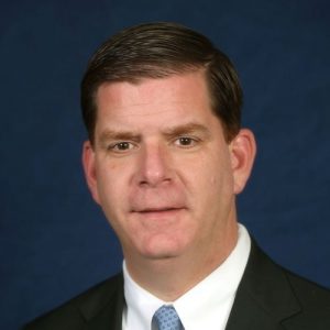
Mayor Martin J. Walsh of Boston is a 2014-2015 fellow with the Rose Center for Public Leadership.
Boston continues to attract newcomers with its thriving job market, diversified economy, and strong anchor institutions. Yet, it remains one of America’s least affordable cities where a large percentage of residents spend at least 50 percent of their income on housing. The city has pledged to create 53,000 new units of housing by 2030, and the Washington Street Corridor is seen as a potential zone for growth, the fellows say.
At present, the area is “screaming out for density” with underused land and structures, says Danny Green, deputy chief of policy for Mayor Martin J. Walsh and the team’s coordinator. The past few years have seen a flood of new development applications for mixed-use and residential developments along the corridor. Its accessibility to two transit stations on the Massachusetts Bay Transportation Authority (MBTA) Orange Line—the Forest Hills and Green Street stations—makes it a perfect choice for transit-oriented development.
Currently, the Washington Street corridor is auto-oriented and not bike- and pedestrian-friendly, even though many local residents do not own cars and rely on public transportation. The Rose Center study panel recommended improving connections between neighborhoods, to trains and buses, and to parks and other amenities through wayfinding signage and other upgrades. The panel also suggested doing an inventory of the housing stock along the corridor to determine current residents’ needs and stepping up code enforcement efforts to maintain existing housing stock.
Perhaps the panel’s most impactful recommendation was to break up the corridor into distinct east-to-west nodes with unique identities. While high-density, mixed-use development makes sense for the area surrounding the Forest Hills and Green Street stations, infill and medium-density development might work better for the streets near Egleston Square, a mom-and-pop retail and commercial district at the north end of the corridor.
“We kept seeing it as a monolithic corridor, but what the panel envisioned was multiple, smaller neighborhoods,” says fellow Sheila Dillon, the city’s director of neighborhood development.
Similar to study areas presented by the Seattle and Pittsburgh teams, the Washington Street Corridor borders working-class communities that risk being displaced as new development occurs. An added complication is that many of the residents are Spanish-speaking, with limited English skills. The study panel reminded the Boston team that the Latino community needs to be more actively engaged. Green says that bilingual outreach will be a priority as the city seeks public input during the BRA’s master-planning process. “The mayor wants the outreach process to be more inclusive and more active,” Dillon says. Her hope is that the planning process for the Washington Street Corridor can serve as a model for other neighborhoods undergoing change.
Omaha: Creating a Thriving Urban Neighborhood in North Downtown
One might say that Omaha is one of America’s best-kept secrets. Its stable but growing economy, low cost of living and unemployment rate, and vibrant arts and entertainment scene make it a desirable place to live. In 2010, the Omaha, Nebraska–Council Bluffs, Iowa, Metropolitan Statistical Area (MSA) was ranked among Forbes magazine’s top ten livable cities. Home to several Fortune 500 companies, including Berkshire Hathaway, Union Pacific, and ConAgra Foods, Omaha continues to attract new companies and benefits from a civic-minded corporate sector.

Mayor Jean Stothert of Omaha is a 2014-2015 fellow with the Rose Center for Public Leadership.
Yet even cities that are doing well want to be doing better. The Omaha team sought the Rose Center’s input on how to weave together a 450-square-mile (720 sq km) area north of downtown into a distinct, 18-hour urban neighborhood that is greater than the sum of its parts.
A formerly industrial area, north downtown Omaha now boasts several venues and attractions that draw both local and out-of-town visitors, including the following: the TD Ameritrade Park, home to the NCAA College World Series; the CenturyLink Center arena and convention center; and the Bob Kerrey Pedestrian Bridge that connects Omaha to Council Bluffs across the Missouri River.
In addition, the area serves as a gateway to Creighton University, a Jesuit institution that is recruiting nationally and that has growing student housing needs, and to a burgeoning arts and trades district in the north filled with so-called maker spaces like the Mastercraft factory, the Hot Shops Arts Center, and the Bench, where small-scale manufacturing and craft-based businesses are taking off.
At its northeast edge, though, the area has retained its industrial character. Large trucks make pick-ups and deliveries in the area, creating traffic and hampering street-level activity throughout north downtown, the fellows say. “One of the biggest challenges of the area is that it’s so diverse in terms of land use,” says fellow Bob Stubbe, the city’s director of public works.
The area also suffers from an excess of surface parking lots at a time when more Omahans want to live downtown in walkable neighborhoods. A recent study showed a 55 percent occupancy rate of the roughly 4,200 parking spots downtown.
Essentially, the Rose Center study panel urged the city to create stronger connections that could potentially support more residential development—the key ingredient to establishing new, mixed-use neighborhoods. The panel also urged the creation of a special leadership team, drawing upon the city’s strong philanthropic sector, which could articulate and pursue a vision for the district.
The panel identified one of these underused lots, Lot B, as a potential linchpin for an 18-hour neighborhood. Although the city has expressed interest in turning Lot B into a mixed-use center, any new project must be sensitive to the supply and demand of Omaha’s real estate market, which is currently experiencing an influx of $1 billion of new investment.
“The timing of [developing Lot B] is really critical,” says fellow Cassie Seagren, Mayor Jean Stothert’s deputy chief of staff for economic development. “We get one shot to do this, and we’ve got to get it right.”
Pittsburgh: Making Almono Work for Hazelwood
The Almono site is named after the three rivers that converge in Pittsburgh—the Allegheny, the Monongahela, and the Ohio. The 178-acre (72 ha) site is currently the largest brownfield redevelopment project in Pittsburgh and the former home of LTV Steel. Since 2013, the city of Pittsburgh has been closely watching plans for the site proposed by its owner, the Almono Partnership, a group of local foundations and a nonprofit development company.
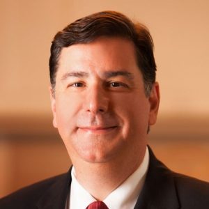
Mayor Bill Peduto of Pittsburgh is a 2014-2015 fellow with the Rose Center for Public Leadership.
The Pittsburgh team was keenly interested in determining how the partnership’s plans for Almono can also lift up Hazelwood, the adjacent neighborhood that has declined in tandem with the steel industry. The fellows also expressed interest in how Almono can improve Hazelwood’s access to downtown Pittsburgh as well as employment centers directly to the north like Oakland, home to Carnegie Mellon University and University of Pittsburgh. At present, Hazelwood can be accessed through only one road—Second Avenue, which becomes Irving Street. Not only does traffic clog Second Avenue, but the narrow sidewalks and the lack of bike lanes further isolate the neighborhood from Pittsburgh and limit opportunity for residents.
The Almono Partnership’s proposal includes four unique sections, capped on either end by mixed-use, high-density nodes with two office/light-industrial commercial nodes in between. The entire site hugs the Monongahela River, and the redevelopment promises prime riverfront access to Hazelwood residents.
While the site plan has several strengths, including an emphasis on sustainable development and light manufacturing and clean industries, the Rose Center study panel urged a revitalization strategy that encompasses Hazelwood rather than one limited to the 178-acre (72 ha) site. One solution the panel proposed is to make all four nodes into mixed-use areas as well as establishing a fifth mixed-use node in the neighborhood. Panelists also suggested revising the development schedule so that earlier phases take place closer to the community and that strategic infill development within Hazelwood can occur alongside.
Fellow Karen Abrams, diversity and community affairs manager at Pittsburgh’s Urban Redevelopment Authority, says she wholeheartedly agrees with the panel’s recommendations, which promote the so-called P4 framework embraced by Mayor Bill Peduto. The framework seeks to balance the needs of people, the planet, place making, and performance of key economic and environmental indicators. “The panel’s recommendations really pulled all of these themes together,” Abrams says. “We’re using this project as a template for how we measure success.”
Seattle: Envisioning Rainier Beach’s Future
The Seattle team chose as their study area Rainier Beach, a series of residential neighborhoods in south Seattle that skirt Lake Washington.
With more than 60 languages spoken in the local school district, Rainier Beach is among Seattle’s most culturally diverse areas. Unfortunately, Rainier Beach has not experienced the kind of private investment found in other Seattle neighborhoods, which have benefited from the wider prosperity created by the city’s high-tech and innovation-oriented economy. It is also one of the remaining few affordable neighborhoods in Seattle since housing costs have soared along with the number of high-wage jobs.

Mayor Ed Murray of Seattle is a 2014-2015 fellow with the Rose Center for Public Leadership.
The opening of a Sound Transit light-rail station at Rainier Beach in 2009 and a 2012 update of the community’s neighborhood plan have done little to galvanize new private commercial or residential development in the area, although public investment has been substantial. In addition to the train station, a Neighborcare Health medical and dental clinic opened in 2011, and a $25 million community center and swimming pool opened two years later.
Rainier Beach has several locally owned businesses and nonprofit organizations, but residents for the most part work throughout the city, using light rail and the city’s bus system to access jobs. At the moment, Rainier Beach feels like an isolated enclave. “A lot of people don’t travel down there,” says Rose fellow Kathy Nyland, the city’s director of the department of neighborhoods. “It’s not really understood as a destination. Part of the equation is the perception” that Rainier Beach is unsafe.
While crime data do not necessarily support this conclusion, a few high-profile shootings and gang-related incidents have negatively affected the neighborhood’s reputation, hampering investment, according to the fellows. One remedy proposed by the Rose Center study panel is to strengthen linkages through infrastructure upgrades and wayfinding between Rainier Beach’s distinct nodes while amplifying its unique culture and character.
For example, one would hardly know that one had entered a diverse, vibrant community when arriving at the Rainier Beach station since it feels cut off from the rest of the neighborhood, says Rose fellow Nathan Torgelson, the city’s deputy planning and development director. Similarly, Lake Washington and Beer Sheva Park are only a mile (1.6 km) away from the station, yet access to these community attractions remains unclear.
And while the new community center and swimming pool attract users from all over Seattle, very few people stop and linger, Nyland says. What would help is a clearly defined retail and entertainment district so that residents could spend an entire day in Rainier Beach instead of driving in and out to use the pool.
A fundamental problem seems to be the lack of a clear vision for what local residents and city leaders want Rainier Beach to become, according to the study panel.
For their part, the Rose fellows have mixed feelings about what private development could mean for this area. Residents in Rainier Beach have been vocal about not looking to the city for any “handouts” and wanting the community to remain theirs, Torgelson says. The fellows couldn’t agree more. “How can development empower the people who already live there?” Torgelson asks. “We think this could be a great test case for what Mayor Ed Murray calls ‘placing without displacing,’ ” or community redevelopment that balances social equity with economic development. One idea spearheaded by local residents is a food innovation center, a kitchen incubator for food-based businesses and retail that can take advantage of proximity to the Rainier Beach station to the Rainier Beach Urban Farm and Wetlands.
But as the Seattle workforce gets priced out of neighborhoods closer to downtown, it seems inevitable that developers will look to Rainier Beach as the perfect place for new transit-oriented development. “It’s not if, but when, it will happen,” Nyland says. “We want to shape it as best as we can.”